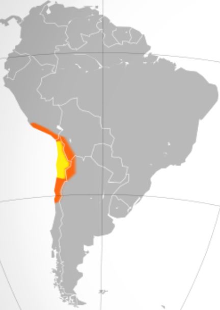
Atacama desert in Chile covers 1600 km is the driest non-polar desert in the world. This is considered to be the only true desert to receive less precipitation than the polar deserts and the largest fog desert in the world. Most of the desert is composed of stony terrains, salt lakes, sand and felsic lava that flows towards the Andes Mountain. One of the prominent characteristic of the Atacama Desert is that it has almost complete lack of precipitation and the Atacama desert maybe the oldest desert on earth as it has experienced extreme hyper-aridity for at least 3 million years.
Despite of having such conditions in the place, Atacama desert is also known for its rich variety of flora present there. Over 500 species have been gathered within the border of this desert and they are characterised by their extraordinary ability to adapt to this extreme environment. Out of which the most common species are the herbs and flowers. This place where the wonder happens is called Desierto florido.
Desierto florido phenomenon usually occurs every five to seven years when rain cause buried seeds to germinate and flower. The average rainfall is just about 15 mm per year in the Atacama region. Although some of the locations receive 1 to 3 mm in a year leading to the blooming of flowers every year during the season. For comparison, the average rainfall in India per year is >1000 mm and for United States, it is 767 mm and for any city would be greater than 100 mm.
The rate of precipitation cause a major significant role in Desierto Florido, as considerable amount of rainfall is necessary for the flowers in the desert to bloom during the season. In the 21st century, the annual precipitation level is lower compared to the 20th century. However, during the years 2001, 2011 and 2015 the precipitation level are 100.12 mm, 86.69 mm and 70.81 mm respectively are high. It is noticeable that the precipitation includes both rainfall and snow. Therefore, the numbers also includes the snow in the Atacama region. Precipitation in Chile varies significantly by latitude and elevation. Especially in Atacama desert where it experiences seldom receive rainfall. Most of the precipitation falling during May and July and almost no precipitation between the months October and March. So, once the precipitation period is complete, the flowers starts to bloom and one can visit Desierto Florido between September and November.

Cool tools to track on the vegetation on Earth:
With the help of Satellite data, the tools like Google Earth Pro and EO-browser: Sentinal hub can be used to track the vegetation on Earth. MODIS Vegetation Index Product (NDVI and EVI) can be used to understand the vegetation of flowers in the desert.
Description of the tools:
MODIS vegetation indices provide consistent spatial and temporal comparisons of vegetation canopy greenness, a composite property of leaf area, chlorophyll, and canopy structure, at 16-day intervals and at multiple spatial resolutions. The normalised difference vegetation index (NDVI), which provides continuity with NOAA’s AVHRR NDVI time series record for historical and climate applications, and the enhanced vegetation index (EVI), which minimises canopy-soil variations and improves sensitivity over dense vegetation conditions, are derived from atmospherically corrected reflectance in the red, near-infrared, and blue wavebands. The two products characterise the global range of vegetation states and processes more effectively.
The vegetation indices are calculated using daily, atmosphere-corrected, bidirectional surface reflectance data. To remove low-quality pixels, the VIs employ a MODIS-specific compositing method based on product quality assurance metrics. A constrained view angle approach then selects a pixel to represent the compositing period from the remaining good quality VI values (from the two highest NDVI values it selects the pixel that is closest-to-nadir). Because the MODIS sensors aboard the Terra and Aqua satellites are identical, the VI algorithm produces each 16-day composite eight days apart (phased products) to allow for a higher temporal resolution product by combining both data records. All ecosystem, climate, and natural resource management studies now successfully use the MODIS VI product suite.
In Google Earth Engine, Terra MODIS Vegetation Indices (MOD13Q1) Version 6 data are generated every 16 days at a spatial resolution of 250 metres (m) as a Level 3 product. Two primary vegetation layers are provided by the MOD13Q1 product. The first is the Normalized Difference Vegetation Index (NDVI), also known as the continuity index to the existing National Oceanic and Atmospheric Administration-Advanced Very High Resolution Radiometer (NOAA-AVHRR)-derived NDVI. The Enhanced Vegetation Index (EVI) is the second vegetation layer, with improved sensitivity over high biomass regions. The algorithm selects the best available pixel value from all 16-day acquisitions. Low clouds, a low view angle, and the highest NDVI/EVI value are the criteria used. The EO browser provides data for observations of land for the bands 1 to 7. The spatial resolution is 250m for band 1-2; 500m for band 3-7.
